| |
|
|

Alone
in the High Sierra
Part I
"Still, the last sad memory hovers round, and sometimes drifts
across like floating mist, cutting off sunshine and chilling the remembrance
of happier times.
There have been joys too great to be described in words, and there have
been griefs upon which I have not dared to dwell; and with these in
mind I say:
Climb if you will, but remember that courage and strength are nought
without prudence, and that a momentary negligence may destroy the happiness
of a lifetime. Do nothing in haste; look well to each step; and from
the beginning think what may be the end."
- Edward Whymper,
Scrambles Amongst The Alps
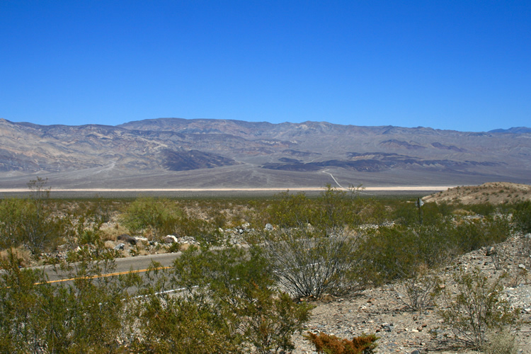
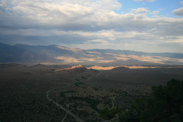
The scorching, desolate
highway through Death Valley National Park
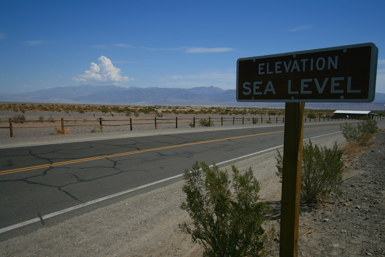
Death Valley, land of extremes. There are several points even lower
in elevation than this within the park and, contrary to what you might
think,
peaks over 10,000 feet as well. The lowest point in the contiguous 48,
in Death Valley NP, is actually only about 60 miles from Mt. Whitney.
Scrub brush,
the “Devil’s Cornfield”, and mountains kicking up
a storm beyond.
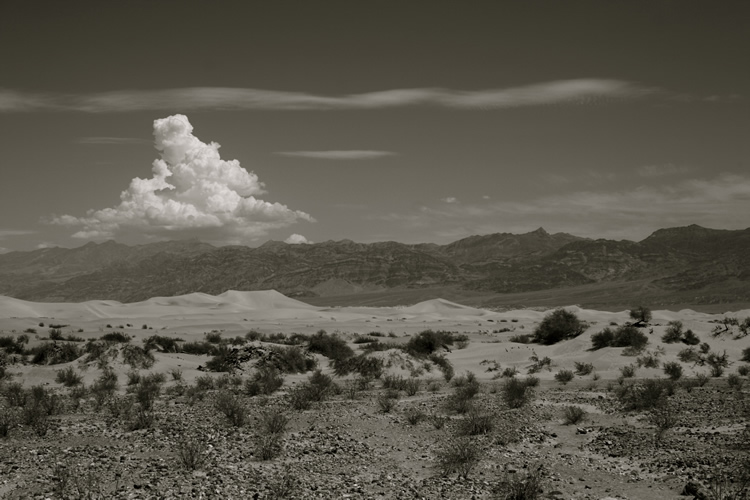
After clearing the last of the Death Valley ranges, there’s only
one place to go. There’s no roads passing through these mountains,
without traveling several hundred miles out of the way. Mt. Whitney
is visible here, the distant peak just to the right of center and touching
a cloud.
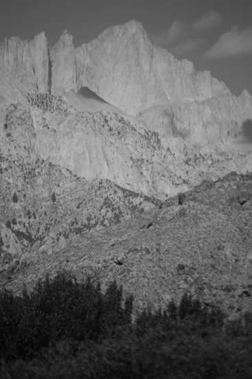
This photo and the next were taken from the Eastern Sierra Inter-Agency
Visitor Center’s parking lot. Just outside Lone Pine and a mere
twelve miles from the mountain.
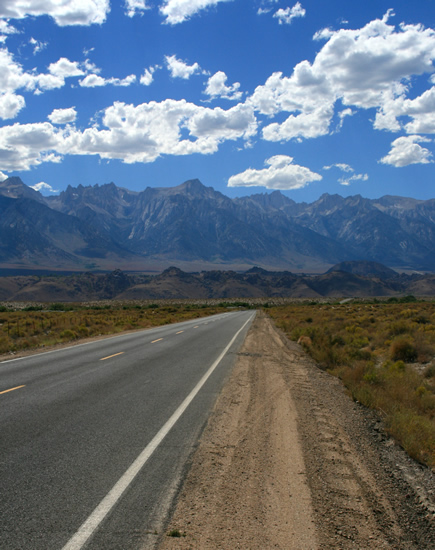
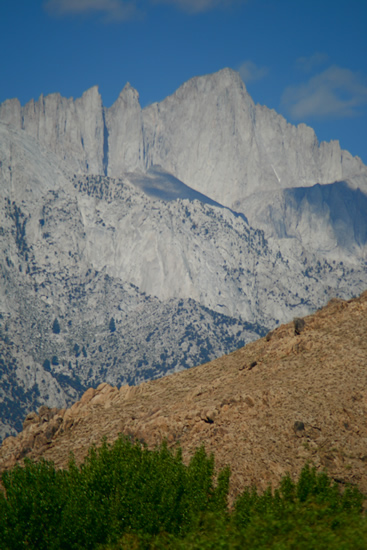
Whitney looms over the valley and the small town of Lone Pine, CA
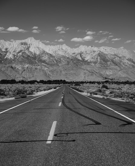
The road into Lone Pine, looking due west. At this point I was feeling,
to put it mildly, somewhat intimidated.
Mt. Whitney from a mere twelve miles away in Owens Valley
An overlook
halfway to Whitney Portal, looking down on Whitney Portal Road, Lone
Pine, and the Owens Valley beyond.
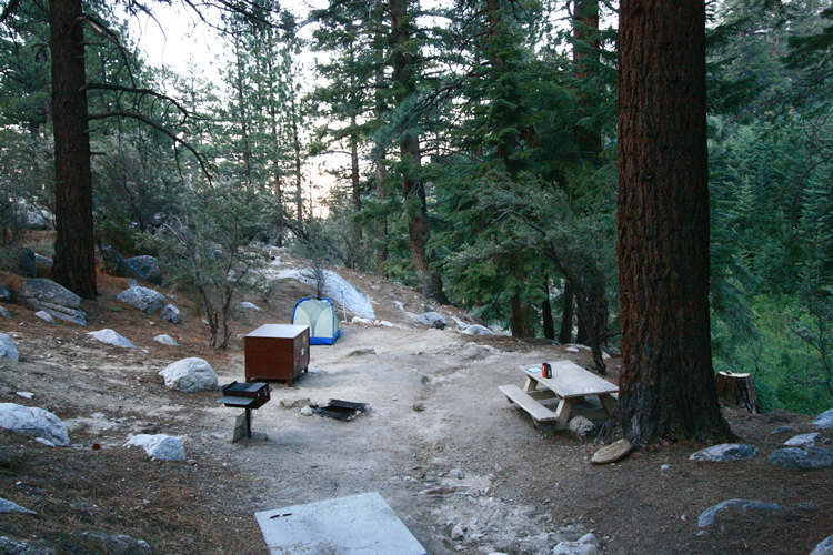
Camp 1, at Whitney Portal, elevation 8,300 feet.
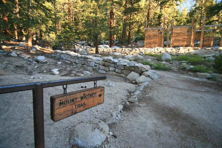
The main Mt.
Whitney Trailhead at dawn. The Mountaineer’s route follows the
main trail for the first mile or so, before breaking
off and heading almost straight up alongside the North Fork of Lone
Pine Creek.
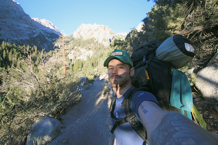
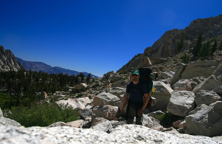
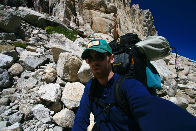
I may not look it, but I’m excited to be off and on the trail.
Just getting to that point, where boot finally meets trail, can really
take a lot out of you.
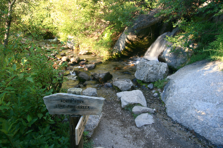
The break-off
point for mountaineers. The main trail crosses the North Fork of Lone
Pine Creek, the Mountaineer’s Route
takes a direct right turn and follows the creek closely, and steeply
straight up the rocky and willow choked valley.
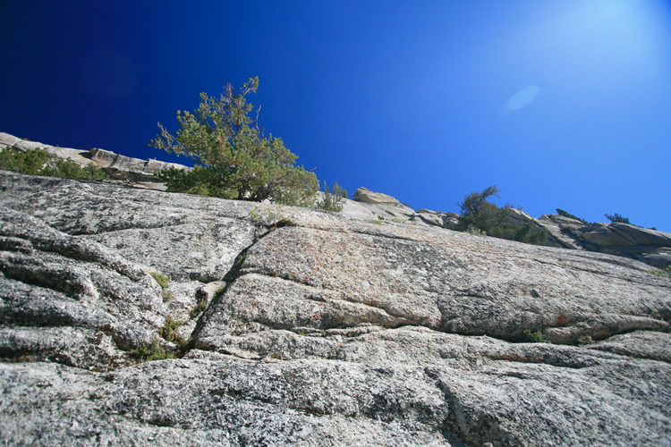
My first look
at the famed Ebersbacher Ledges. The ‘trail’ or climb starts
at the tall lone pine in the lower left of the frame and works it’s
way up and to the right,
before eventually zagging back to the left toward the stand of pines
higher up. It’s quite difficult to follow, but easy enough to
know when you’ve gone the wrong way.
If you do you’ll soon find yourself on the gravelly edge of a
sheer 150 foot drop.
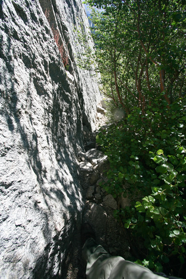
The approach
to the base of the ledges, barely wide enough for me and my pack to
get
through. My foot is in the bottom of the picture, an attempt to give
some scale to the wall.
The first
section of climbing on the Mountaineer’s Route, the beginning
of the ledges.
This view is looking almost straight up, and those boulders are roughly
dining room table sized.
Once up the
boulders at the start, this is what confronts you. A sheer vertical
wall on your left and a steep, though not yet high, drop off to the
right.
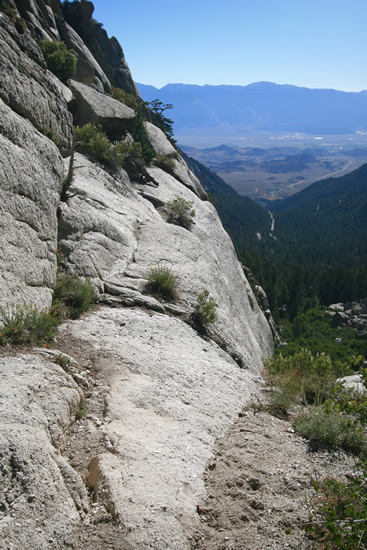
The first
turn on the ledges, the path here is straight ahead in the picture and
only about a foot wide. You can see what awaits a slip on the right.
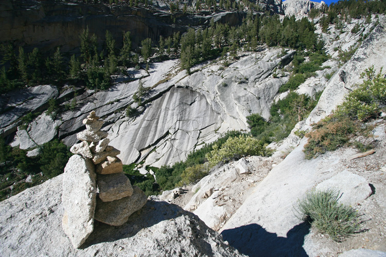
A cairn helps
mark the way, although it’s halfway up the ledges so you’ve
got to find your way there first. Reassuring nonetheless.
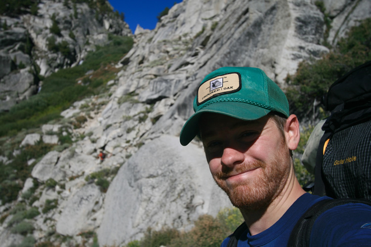
At this point
I’m past the Ebersbacher Ledges, hence the smile. It was certainly
hair raising, but I managed to avoid any serious slips or wrong turns.
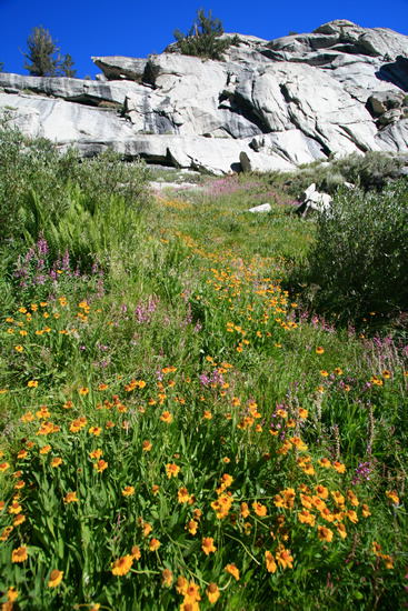
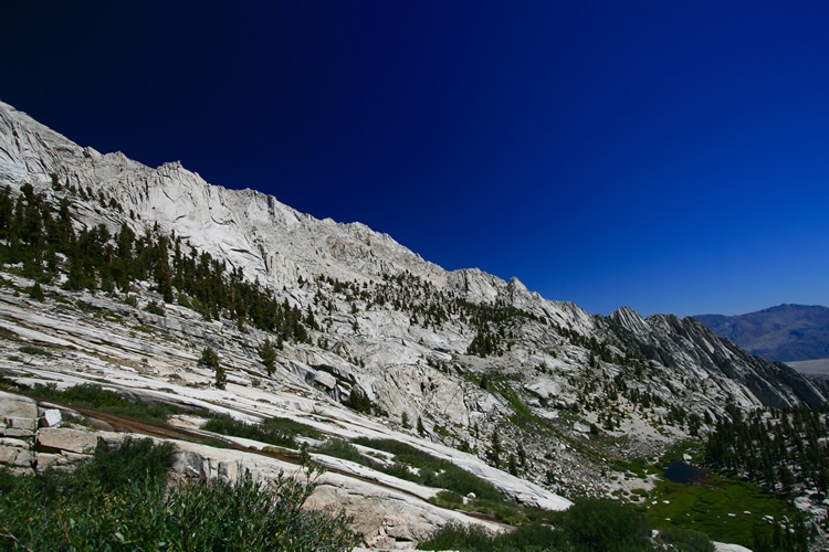
Some flora
of the upper alpine region in a nice meadow on the way to Lower Boyscout
Lake.
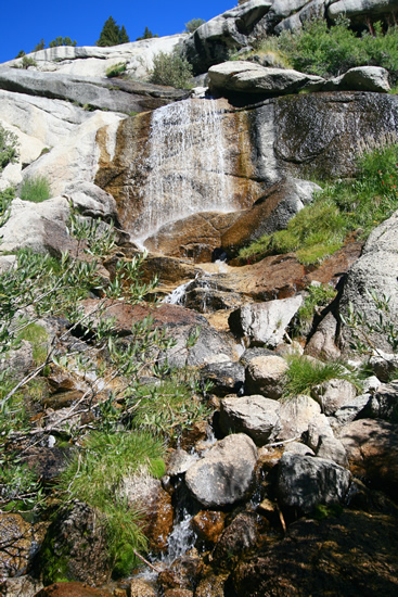
One of the
many waterfalls making up these high parts of Lone Pine Creek. You can
hear the creek constantly and from far off due to it’s constantly
cascading steepness.
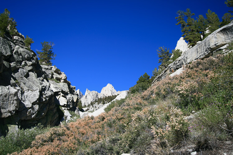
For the first
time since hitting the trail Mt. Whitney Comes into view, looking no
less intimidating of course.
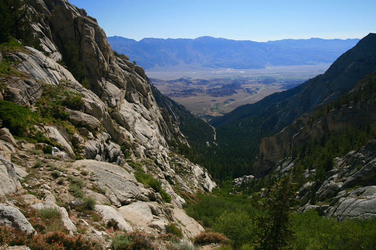
Finally gaining
some height. You can get a sense of the grade of the creek here,
and I was really starting to feel the elevation after crossing the 10,000
foot mark, despite having spent a night at 8,500.
The next step
is to conquer those slabs in the foreground, and from this vantage the
famed ‘chute’ or couloir that marks the way up to the summit
block is almost straight ahead.
From here I could already tell the couloir was still at least partially
snow-covered.
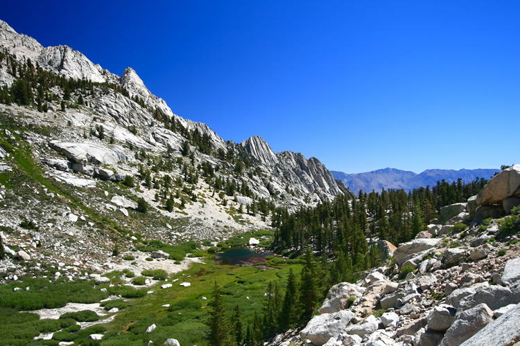
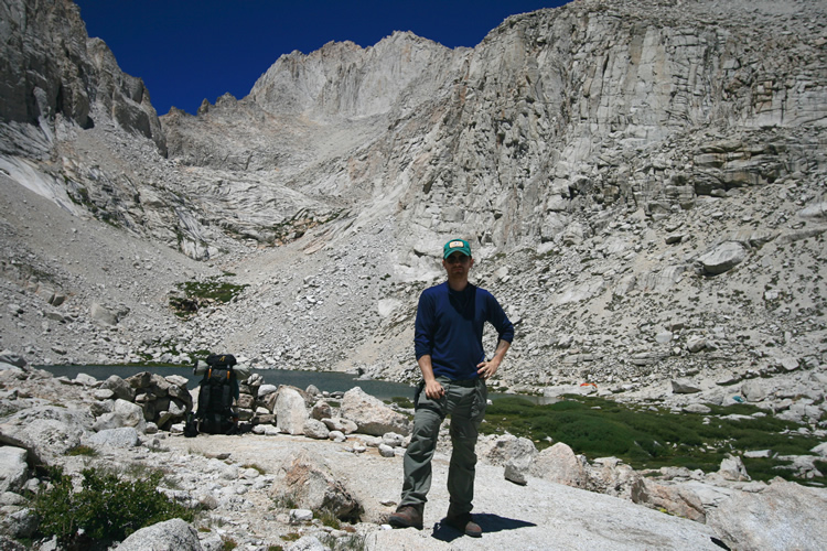
The Whitney
region as seen from Lower Boyscout Lake, elevation 10,500 feet.
Lower Boyscout Lake from above, about halfway up the massive boulder/talus
field that leads to the ‘slabs’.
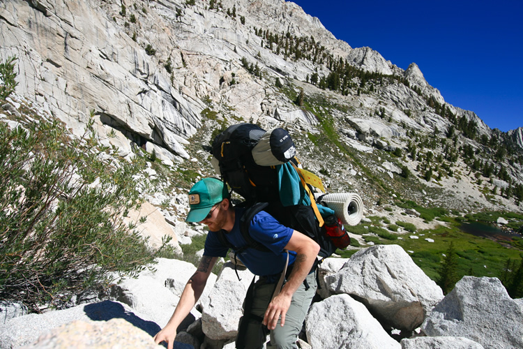
Ascending
endless boulders, constantly aware of the disaster a broken leg, ankle,
wrist, or arm would be at this point.
Maintaining balance on this terrain is hard enough already without the
fifty pound pack I’ve got.
Boulders – nature’s tripod.
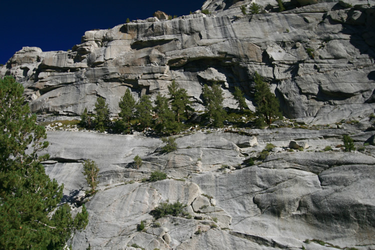
Now high above
Lower Boyscout Lake, ascending the slabs visible to the left in the
foreground. Steep but at least easily gripped where dry.
At last Upper
Boyscout Lake, elevation 11,400 feet. Here I made my first mistake by
continuing on to Iceberg Lake. I’d planned on spending the night
at upper
Boyscout to rest and acclimatize some more. Then attempting the summit
from there. As they say; climb high, sleep low.
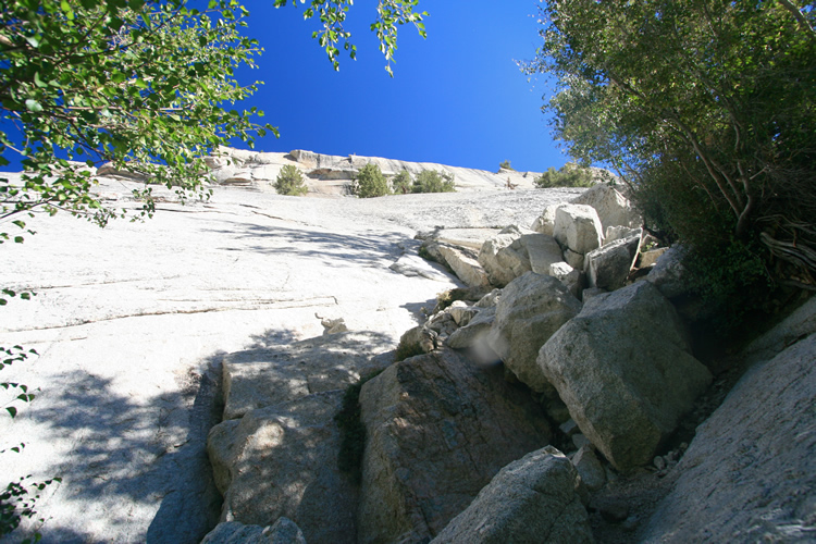
The road out
of the Upper Boyscout Lake region, going from mostly barren to totally
so.
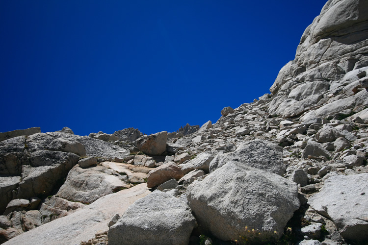
This picture was taken looking almost straight up, and unfortunately
was where I had to go.
Mt. Whitney
and The Needles are obviously closer now, and their full magnitude is
now undeniable.
Here I am
feeling extremely winded, dehydrated, and more lost by the minute. At
this point the mistake started to hit me.
It was getting late (relatively, the sun would be dropping behind the
very high mountains early, around 4:30pm).
And on this section I was going from one lake to another but was no
longer following the creek, and therefore running dangerously low on
water.
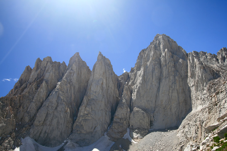
Mt. Whitney
on the right, and what are called the 'Needles' to the left. They're
a big climbing destination for the more experienced.
Actually met several people headed to or from the Needles on my hike.
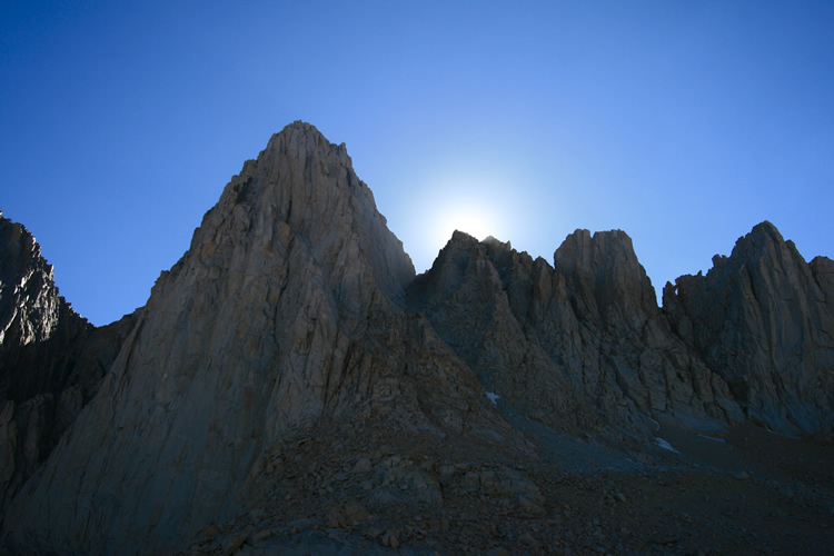
The 'sunset',
if you can call it that, behind Whitney and the notch, at around 4:30pm.
Made it up to my destination just in time,
after the sun dropped behind the range I lost light and warmth extremely
fast.
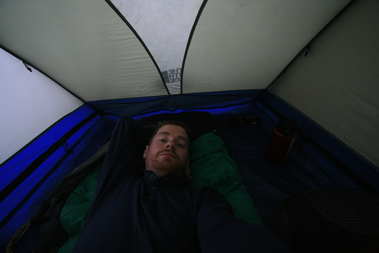
In the tent,
after dinner, whipped and ready for bed by about 7pm.
Wrote for a bit but was having trouble keeping my thoughts on the simplest
things, a testament to the elevation.
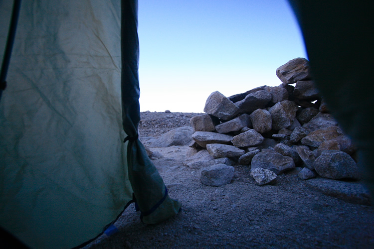
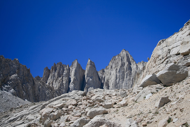
The moonscape
outside my tent and camp at Iceberg Lake, elevation 12,600 feet.
"I cannot now tell exactly, it was so long ago, under what circumstances
I first ascended, only that I shuddered as I went along (I have an indistinct
remembrance of having been out overnight alone),
- and then I steadily ascended along a rocky ridge half clad with stinted
trees, where wild beasts haunted, till I lost myself quite in the upper
air and clouds, seeming to pass an imaginary
line which separates a hill, mere earth heaped up, from a mountain,
into a superterranean grandeur and sublimity. What distinguishes that
summit above the earthly line,
is that it is unhandselled, awful, grand. It can never become familiar;
you are lost the moment you set foot there. You know the path, but wander,
thrilled,
over the bare and pathless rock, as if it were solidified air and cloud.
That rocky, misty summit, secreted in the clouds, was far more thrillingly
awful
and sublime than the crater of a volcano spouting fire."
- Thoreau, Journal
to be continued in issue 52...