| |
|
|

Alone
in the High Sierra
Part II
(Alone in
the High Sierra - Part I)
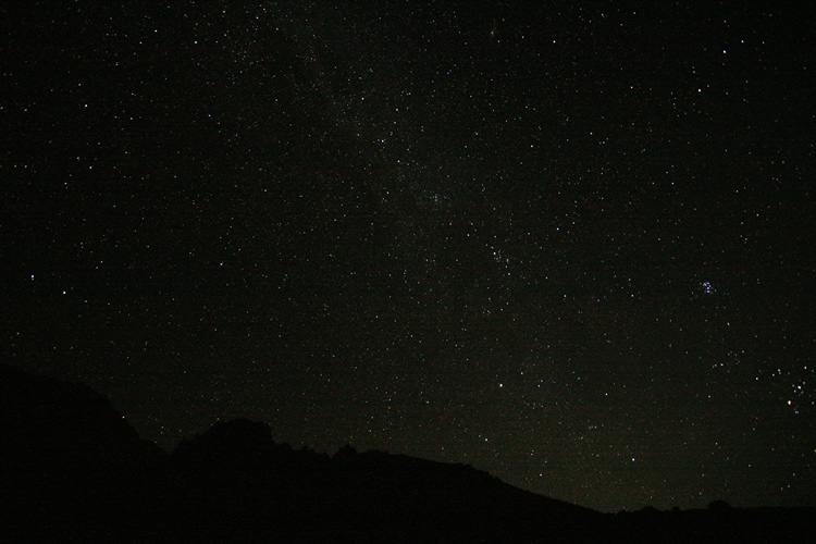
Night falls and the Milky Way rises unabated by light pollution, or
a good portion of the atmosphere for that matter.
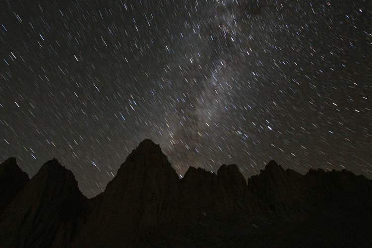
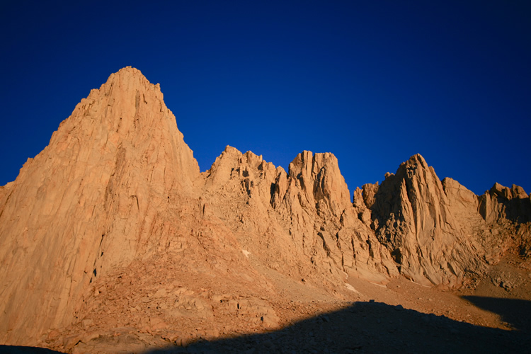
Mt. Whitney
as one can only see up close and personal, and much as it looked in
my dreams. Got up around 2am to take these night shots.
It was 38 degrees Fahrenheit outside and the wind was whipping out of
the southwest, making for a cold hour or so while I captured several
long exposures.
Took fewer than I would have liked, but frankly considering the circumstances
(middle of night, freezing, 12,600 feet), I was happy I got any keepers
at all.
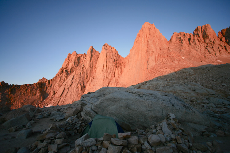
Dawn at my
highest campsite ever, 12,600 feet. This was incidentally roughly my
personal highest elevation ever achieved (on foot) to that point,
nearly matching the height of the summit of Humphrey’s Peak in
Arizona (12,633 feet), which I’d climbed just five months prior.
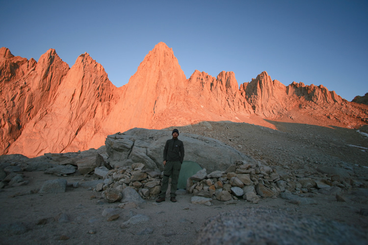
Taking in
the beauty of such a high dawn, and kind of stalling departure of camp.
The last 2,000
feet, waiting to be climbed in perfect (for now) weather.
Fortunately weather in these mountains in August, this far south, is
as reliable as can really be hoped for in any mountains.
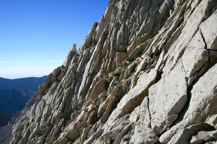
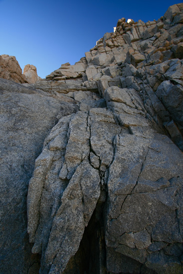
Once into
the couloir, this is the grade of the majority of the last 2,000 feet
to the top. All except the last 350 vertical feet or so, which are even
steeper.
Some of it bouldering, some full on class 3+ climbing, and some trying-not-to-trigger-rock-avalanche-ing.
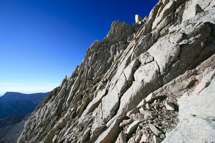
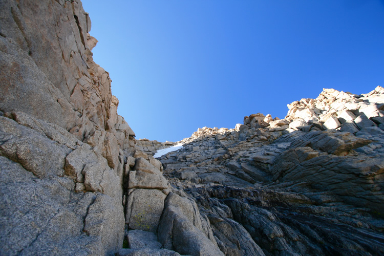
The view looking
up the couloir. Lots to go.
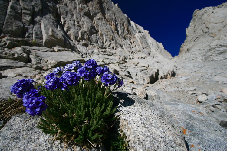
It’s
little surprises like this beautiful patch of Sky Pilot, holding fast
to granite and little else at 13,000 feet, that can kick up your spirits
and keep you going in moments of doubt (which may strike few travelers
up the Mountaineer’s Route, but did me).
A particularly
exposed and cramped vertical section. Not only did the climbing and
level of exposure have me rattled by this point, but so did exhaustion.
I had to pause to chug air, for minutes at a time, every few steps.
Felt like I was getting nowhere but in hindsight actually made pretty
good time.
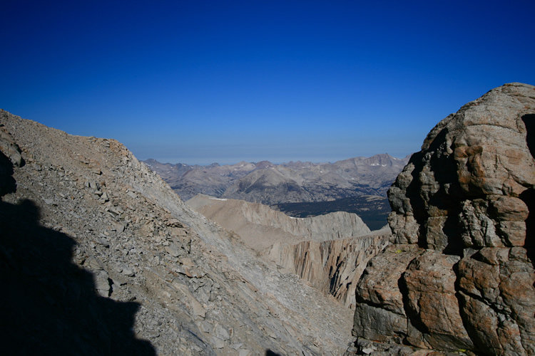
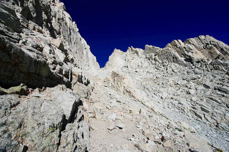
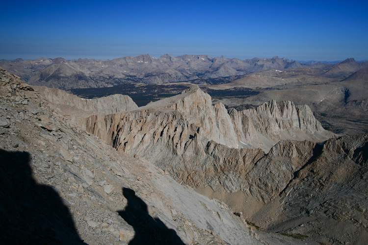
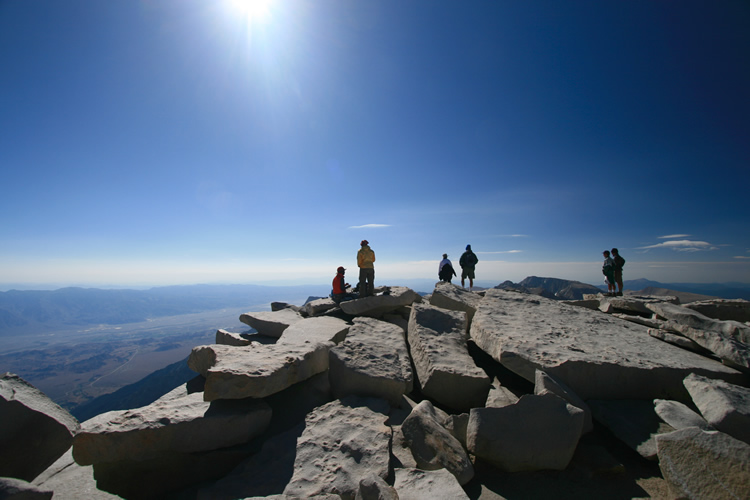
At last, ‘the
notch’, the top of the couloir and the first view over the shoulder
of Whitney and into Sequoia/King’s Canyon National Park, the Great
Western Divide, and beyond.
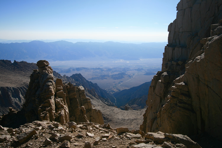
Looking back
through the notch, to the east, with the creek, Whitney Portal, and
Lone Pine far below.
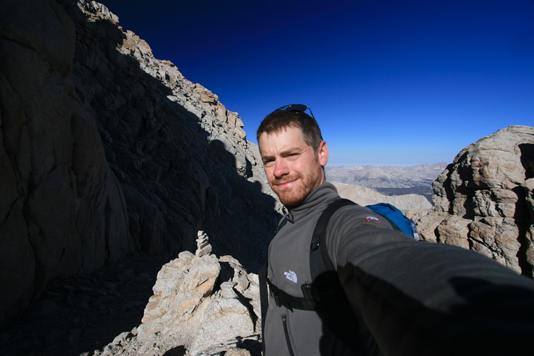
Me at the
notch, proud but still nervous and getting more so. The summit pyramid
is to my left, up through the steep rocks still in the shadow of the
peak.
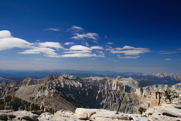
Looking due
west from the notch.
The beginning
of the end, the last 350 feet to the summit, almost straight up.
The sun touching the top is part of the summit plateau, which is actually
quite broad and sloping off to it’s western flanks.
Part of the
way up. After a mind-altering, heart busting, and panic inducing slip.
I made a long reach for a precarious hold, and missed with my foot.
Instead of hitting dry granite I hit a patch of ice. As my feet slipped,
I couldn’t hold with my hands and started to slide down the rock.
I did my best to hug the rock as I slid to avoid gaining momentum, and
after about five to seven feet my feet hit a ledge and I held on.
I took this half to test the camera, which took a slam or two, and to
test myself. Mostly, to see if I could function.
Not due to injury, just absolute, crippling fright. I was near panic,
and had to talk to myself for several minutes before I got a grip.
After this I took no more pictures until the summit, unconcerned with
anything but getting safely up, then down.
Unbelieveably,
the summit. 14,496 feet. I was on the verge of tears most of the nearly
two hours I spent on top. Frankly, I hardly enjoyed it.
There was some satisfaction and more than a little pride, but I knew
it would be wasted effort if I didn’t return safely.
And at that point I wasn’t exactly brimming with confidence that
I could do so.
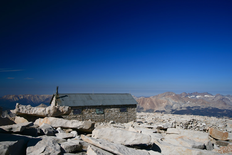
The summit
shack.
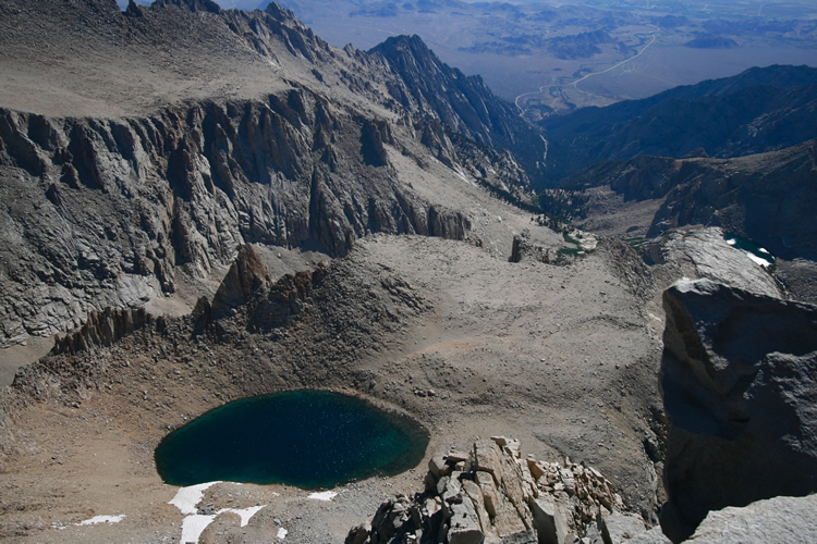
Iceberg Lake and my camp far, far below.
Signing the
summit register.
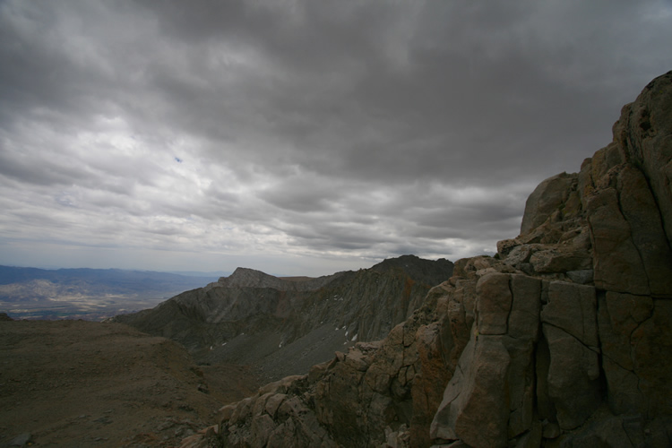
Looking southwest
from the summit. Benign looking clouds would quickly give way to troublesome
weather.
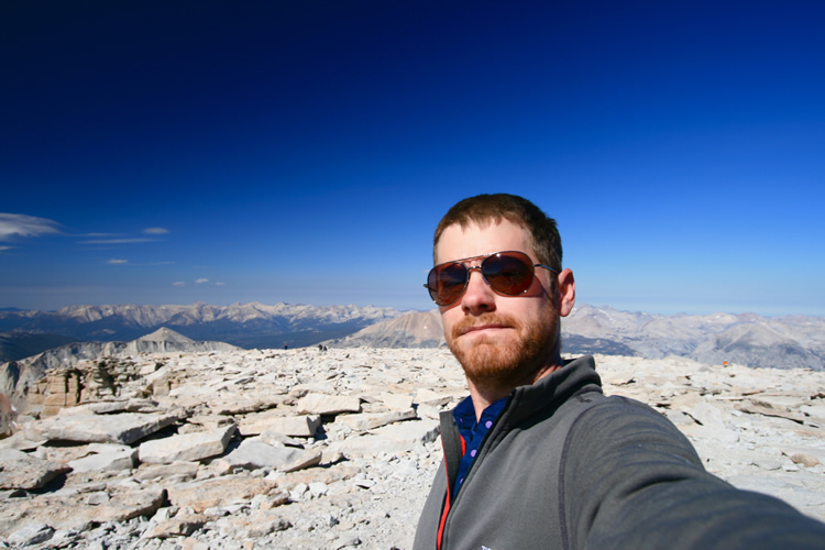
Me on the summit. Notice the lack of enthusiasm, still in shock from
the shaky final section.
The last half hour on top I was actually just waiting, hoping, that
someone else would come up the Mountaineer’s Route that I could
befriend and descend with.
It was my lucky day (lucky again I should say, after all I could’ve
fallen to my death earlier) as when I was close to packing it in and
attempting
to make my own way back down in a state of absolute fright another climber
came over the rise from the direction of the Mountaineer’s Route.
After he’d enjoyed his own solo summit achievement for a while
I promptly introduced myself and made my situation clear.
He was more than enthusiastic about my proposal to descend together,
which I was indescribably elated to hear.
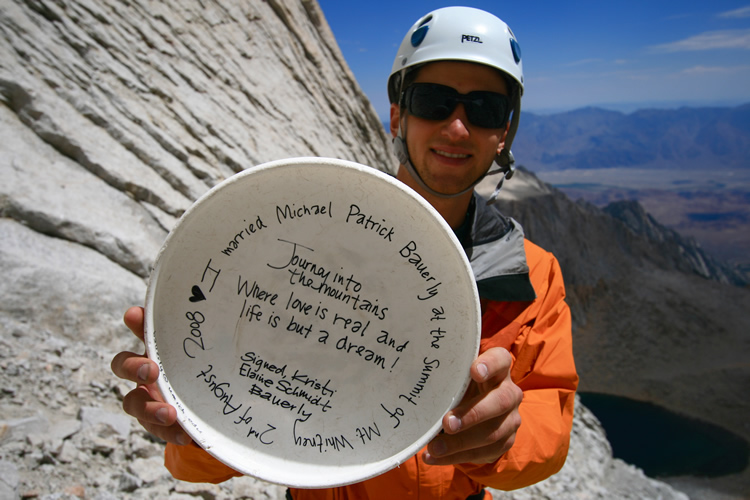
My new friend,
Jeff, holding the marriage Frisbee tossed from the summit only two days
prior by the newlyweds that we found on our way back down the couloir.
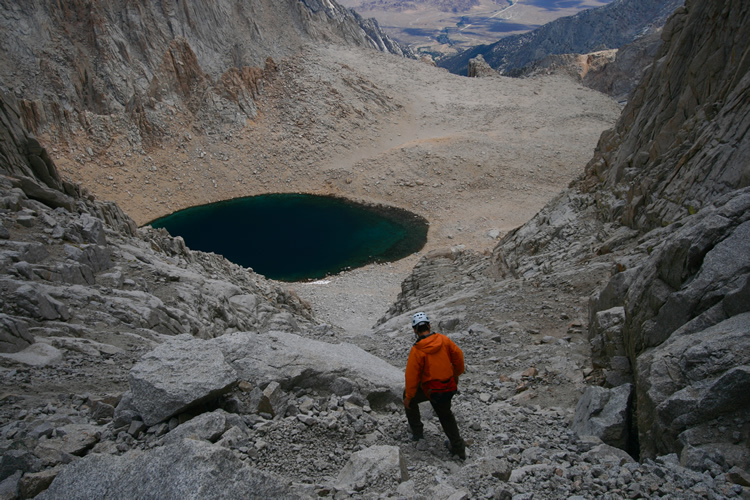
Descending
to Iceberg, challenging no doubt but, step for step, with relief and
safety closer with every step, perhaps more satisfying than the climb
to the top.
The weather
turns, thankfully on our way down. It held for the most part, sparing
us a downpour as we hiked all seven miles and 6,000 vertical feet down
to Whitney Portal. There I bought burgers and beers for Jeff and I at
the famed Whitney Portal Store before we went our separate ways.